
 Day Rides for the Ridin’ to Redmond 2024 BMW MOA Rally have been published!
You can find all the day ride routes here: https://ridewithgps.com/collections/2244945
We currently have 5 paved routes and 5 routes that are not completely paved. We’ve done our best to take you to fantastic places and great views with some awesome riding along the way. All while still giving you some time at the Rally!
To highlight a couple routes right now, here’s two of our favorites:
 McKenzie Run
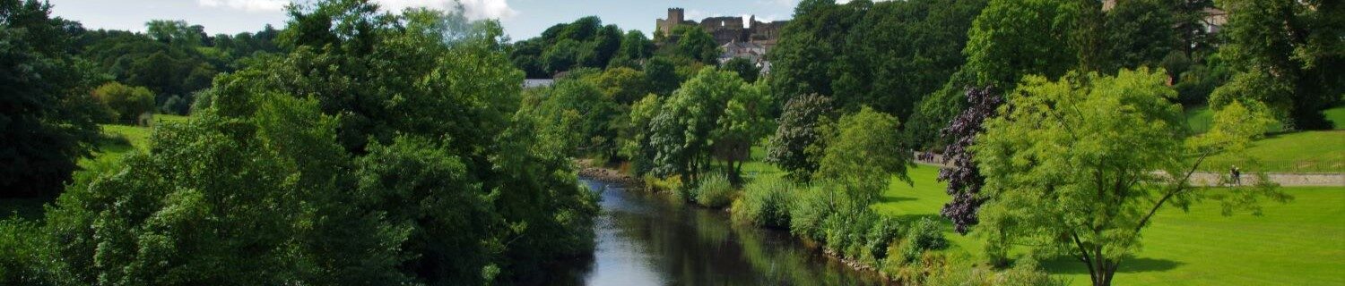
More commonly known as the Santiam Pass Scenic Byway, McKenzie Pass is the real attraction on our McKenzie Run.
Along OR 242, you will find the Dee Wright Observatory, hewn from lava rock and oriented to highlight all the major peaks of the central Oregon Cascade Mountains. A great place to see and learn about all the different mountain peaks in the area.
Be careful — OR 242 is super fun, narrow, twisty and cars and bicycles may lurk around every corner. Be sure to checkout the Sahalie and Koosah Falls along OR 126 on your way back before you crest the Santiam Pass on US 20.
https://ridewithgps.com/routes/46551173
NOTE: McKenzie Pass / OR 242 has yet to open for the season and may be closed from one side for road resurfacing. For current status, see the ODOT website: https://www.oregon.gov/odot/regions/pages/mckenzie-highway.aspx
 Green Ridge
This is a group of onX:OffRoad routes based around their Green Ridge route. Off-pavement starts just outside of Sisters, OR and takes you to Zimmerman Butte and the adjacent cinder pit.
While the route is approximately 160 miles, be sure to visit the Camp Sherman Store and Fly Shop. It's also your last chance for fuel until the other side of Lake Billy Chinook.
The Abbot Butte Loop has the highest technical rating from onX:Off-Road on this route but can be easily by-passed.
Most of the route is typical National Forest access roads and maintained. Remember, current and recent weather conditions will affect them.
Route returns you through The Cove Palisades State Park area of Lake Billy Chinook. Then on to the towns of Culver and Terrabonne where there are opportunities for Lunch or Dinner on your way back to the Deschutes County Fair & Expo Center.
https://ridewithgps.com/routes/45894844
 USING RIDE WITH GPS
Ride with GPS is a great way for the MOA to share and distribute maps, GPS routes and turn-by-turn instructions. As with any great service, some best practices in the form of tips and tricks are in order.
- Each route in Ride with GPS is equivalent to a track in the world of Garmin GPS units and BaseCamp software. So for all the routes, make sure you get the entire collection of routes in Ride with GPS.
- Ride with GPS allows you to download many different GPS files types, including GPX, for the BMW Navigator series and other Garmin productsWhen downloading GPX files, only download the "GPX Track" version.
- The "GPX Route" version will leave you at the mercy of the settings on your Garmin GPS, and will take you off the planned route and maybe to unexpected places and road conditions.
- Once you have the "GPX Track" version loaded on your device and want turn-by-turn navigation, convert the "track" on your Garmin GPS to a "trip."
- If you don’t have a dedicated GPS device and use your phone for navigation, Ride with GPS also has a number of file formats to work with various navigation apps for phones.
- Ride with GPS also has its own phone app that will also help guide you! Download now for Apple iOS or Android.
Still Unsure How You’re Getting To Redmond?
If you’re thinking about the Eisenhower Interstate System, then take a look at our Interstate Not So Bliz! article on the BMW MOA Rally website for links that should make the interstate travel less of a drone.