
Whether you're coming to the Rally, going back home or just looking for a great day ride while you're in here, Virginia has some of the most amazing roads you'll find anywhere in the mid-Atlantic states. From tree-lined country lanes to technical, curvy mountains roads, you'll find it all in Virginia—and that's without having to venture off-road for any of it!
Having lived in Virginia for my entire life as a motorcyclist, I've ridden all of these roads, some of them multiple times. Trust me when I tell you they're all worth your attention during your motorcycling vacation to Virginia.
Don't forget to check out our collection of downloadable routes from Ride With GPS!
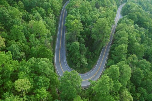
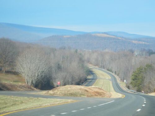
1. Virginia Route 16, with 300 curves in 32 miles, is known colloquially as the Back of the Dragon and is the state's only designated motorcycle road. The north end of this amazing road is in Tazewell, one of southwest Virginia's many small cities now recovering from the collapse of the coal industry. There are numerous great places to stay and eat, and other small SWVA cities like Bristol and Abingdon are nearby. You could easily spend a week in Tazewell, enjoying the many wonderful roads in the region. VA 16 continues on to meet up with US 58 in Volney, providing easy access to the rest of the state. The stretch from Tazewell to Marion is particularly amazing and not just because you have to ride through a town called Frog Level! Find out more at backofthedragon.com.
2. US Highway 58 is the longest road in Virginia. You'll see everything Virginia has to offer visitors from one end of this road to the other, from mountains to beaches. Pick up US 58 at Cumberland Gap, just across the Virginia state line in Tennessee, and if you have time, ride the entire 500-mile stretch of US 58 to Virginia Beach. Alternately, you could pick up US 15 in South Boston and follow other US highways to Richmond and on to the rally site.

3. The Blue Ridge Parkway connects the Great Smoky Mountains National Park in North Carolina to Virginia's Shenandoah National Park. A little under half of the BRP is in Virginia, and if you can handle the low-speed limit (45 through most of the park), you'll be hard-pressed to find better views in the state.
4. You can't drive (or ride a motorcycle) on the Virginia Creeper Trail, but if your trip to or from The 50th takes you anywhere near Abingdon in the far southwest corner of the state, it's well worth your time to walk as much of the 35-mile Virginia Creeper Trail as you can—or rent (or bring!) a bicycle and cover more of it that way.
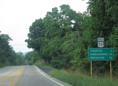
5. US 11 is the most scenic and relaxing way to traverse the western spine of Virginia, especially if you despise the idea of dodging construction and heavy truck traffic on I-81. What Virginians historically called the Valley Road is now a well-maintained US highway built largely on the 18th-century Valley Pike; it parallels the interstate from Bristol to Winchester. If you're riding to or from the rally site through the western third of the state, you can easily leave US 11 and cross Virginia to get to the Rally in a number of locations and stay off the interstates completely.
6. Skyline Drive is another road-specific National Parkway; it runs 105 miles through some of Virginia's most beautiful countryside, terminating in Shenandoah National Park and connecting easily to the Blue Ridge Parkway near Rockfish Gap, which is easily accessible from I-64 and thus an easy way to get to or from the rally site near Richmond.
7. US 33 covers about 120 miles between Richmond and Harrisonburg. If you're staying at the Rally's preferred hotel (Virginia Commons), you're already near where the best parts of US 33 start. While you can follow the road into downtown Richmond, you're better off heading north from Glen Allen. You'll pass through numerous small towns, traverse miles of beautiful Virginia countryside and get a good look at the George Washington National Forest. As you approach Harrisonburg, you'll go over the spine of the Blue Ridge through Shenandoah National Park. Harrisonburg is 105 miles from Glen Allen, allowing an easy out-and-back day trip with plenty of time to get lunch and explore Harrisonburg before heading back for the evening's entertainment at the Rally. Ride In: US 33 from the West. Downloadable route from Ride With GPS.
8. Though a ride along US 522/211/340 from Culpeper to New Market covers just 50 miles, you'll want to run it both directions at least once, because it's 50 miles of amazing scenery and—once you pick up US 211 to go over the mountain—some of the most fun, most technical mountain curves you can possibly imagine. Watch for speed traps on the mountain.
9. The Colonial National Historical Parkway is—well, it's another road-based park in Virginia! It starts at the Colonial Williamsburg Visitor Center just south of US 60 in Williamsburg and runs ESE to Yorktown and US 17, passing through Colonial National Historical Park and the Yorktown American Revolution Museum before ending at Yorktown Battlefield. It's 13 miles of Virginia byway stuffed full of Revolutionary War history, all easily accessible from the Rally site.
10. Richmond-area riders know the Nickel & Dime (VA 5 & 10) as a beautiful day ride proving beautiful scenery, low-stress riding and plenty of opportunities for sightseeing and a great meal. Take VA 5 east to Jamestown and grab lunch before crossing the James River on the ferry and heading west to Hopewell via VA 10. From Hopewell—another good food stop if you weren't hungry before—it's easy to hop on I-295 for a quick return to the rally site. Here's another route you can ride to enjoy a look at some of Virginia's colonial history, one of the routes we've got for you on Ride With GPS.
Honorable Mention: Known as the Snickersville Turnpike, VA 734 connects US 50 near Aldie to Bluemont and VA 7, both of which are major east-west thoroughfares for anybody looking to escape from (or go to) the population-dense Northern Virginia suburbs. This is a nice, easy ride through farm country, with fun elevation changes and sweeping curves. Hop over to Berryville on VA 7 and take US 340 north into West Virginia for more spectacular riding and easy access to Winchester for food or lodging.
The best part of Rte. 33 is from Harrisonburg west which is left out of the list. Also Rte. 250 from Staunton to the West Virginia state line is really fantastic with beautiful scenery and great twisty roads. Rte. 84 which runs from Vanderpool in Highland County to West Virginia is incredibly scenic and has wonderful broad sweepers to ride. There are many many more left out but I am thinking the listing is using the rally gathering as the focus.
This article says the Blue Ridge Parkway has an admission fee (Eagle Pass) which is incorrect. You need a pass to camp, but to ride the road it is free. There are lots of entry and exit points to the Parkway and many of those roads can be nice twisty roads to explore. The Skyline Drive which is controlled entry at both ends, runs from Front Royal to Waynesboro where it becomes the Blue Ridge Parkway. The Skyline Drive does require a pass or admission fee to enter and ride the route. It is posted for 35MPH and is well patrolled. If there is a bicycling event on the Skyline, then forget about it. The cars get stuck behind the bicyclist and passing (legal or otherwise) opportunities are rare.
The Dragon’s Back is a nice ride and not too far from exploring Brooks’s Garden, an area in a bowl of the mountains that takes you back many years in time.
The Virginia Creeper Trail is best done by bicycle. In Damascus, VA which is on RT 58, has many bicycle (regular and electric) shops that you can rent. They have shuttle services that will take you to the top of White Top and you can ride all the way back, mainly downhill back to Damascus. Rt 58 headed east out of Damascus runs along a river and is nice and twisty. Caution in the corners as loose gravel can be present.
All the rides I address here are a minimum two hours from Richmond and Marion ( RT 16 Dragon’s Back) and Damascus are 5 hours or more to get to so plan accordingly.